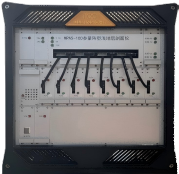
● Acquiring the sub-bottom structure of the near-shore-ocean floor
● Detecting the conditions of shallow buried targets on the near-shore ocean seabed
● Wet end:transducer,20 meter cable.
● Dry end:including transmitter,receiver,power supply and processing controller.
The HY-MPSB 100 is a parametric array sub-bottom profiler, developed by our company in collaboration with the East China Sea Station of the Institute of Acoustics, Chinese Academy of Sciences. This module collects the shallow seismic geotechnical data of the water bottom by emitting high-frequency acoustic signals with a range of 85kHz to 115kHz and receiving the response of the medium. Based on the principle of phased parametric arrays, this device features a small transducer size, high resolution, high sensitivity and rapid imaging. It is crucial for the exploration of underwater subsurface structures and the detection of target embedding
| Primary Frequency | 85~115 kHz |
| Difference Frequency | 5~20 kHz |
| Pulse Length | 0.05~1ms |
| Primary Frequency Angle | Superiorto 2.5*8 deg |
| Difference Frequency Angle | Superiorto 3*10 deg |
| Primary Frequency Source Level | >238 dB/uPa@1m@(100 kHz) |
| Difference Frequency Source Level | >194 dB/uPa @1m@10 KHz |
| Receiver Bandwidth | Difference frequency/primary frequency/harmonic frequency |
| Acquisition Situation | 128 Ksps@24 bit |
| Dynamic Range | >110 dB |
| Emitting Rate | Up to 40 times/sec. |
| Distance Resolution | <0.05m |
| Penetration Ability | <40m(affected by marine noise and sediment conditions) |
| Working Distance | <500 m(max depth measurement range) |
| Phased Emission | Providing optional emission phased angle,coverage range<±25° |
| Attitude Compensation | Providing Roll and Heave correction and compensation |
| External Interface | GPS,attitude sensor,internal and external synchronous triggering |
| Communication | External network port communication for PC interaction |
| Overview of the Imagery | Providing common two-dimensional profiles, sector profiles and three-dimensional seabed imagery |